WRF CIMA EUROPE OL(eng)
| Layer name | WRF CIMA EUROPE OL | |
| Tag | Meteorological Models | |
| Folder | ||
| Source | [www.cimafoundation.org CIMA Foundation] | |
| Description | The atmospheric model WRF (Weather Research and Forecasting Model) is an open source code conceived and developed since the mid 90's by NCAR (National Center for Atmospheric Research), National Oceanic and Atmospheric Administration (NOAA), U.S. Air Force, Naval Research Laboratory, University of Oklahoma, and the Federal Aviation Administration. WRF is a mesoscale forecasting system designed for both research and operational applications, capable of operating at spatial resolutions from hundreds of meters to hundreds of kilometers.
The WRF simulations are produced in two phases: the first to configure the model domain (s) and prepare the initial and boundary conditions; the second one to execute the predictive model including the dynamic solver as well as the physics packages for atmospheric processes (for example, microphysics, radiative processes, planetary boundary layer). The WRF model is also inclusive of a 3DVAR and 4DVAR variational assimilation package. CIMA Foundation performs on behalf of ARPAL (Liguria Region Environment Protection Agency) two distinct WRF modeling configurations (version 3.9.1), on Dewetra World user may findthe WRF-1.5km OL: Open loop configuration (without data assimilation) with 3 domains respectively having spatial resolution 13.5, 4.5 and 1.5 km with 50 vertical levels. The analysis and boundary data (hourly frequency) data are obtained from the Global Center for Global Practices System (GFS) model at 0.25 degrees of resolution. One run per day (00 UTC) is made with the GFS data with a forecast time horizon of 48 hours to have 2 full days of forecasting. This forecast is performed on computing resources at CINECA and is delivered to ARPAL within 730UTC.
| |
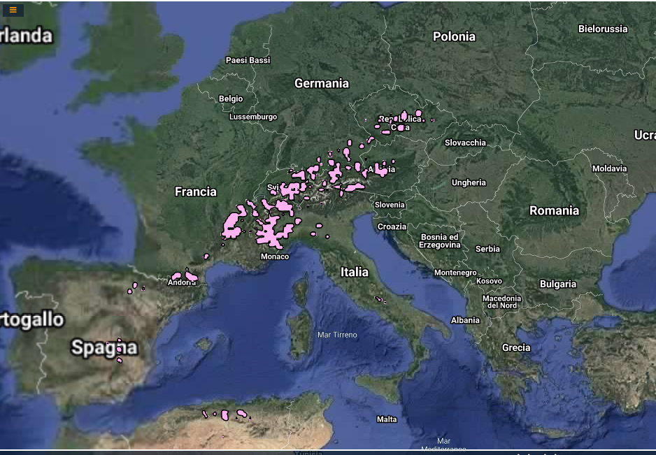
| Screenshot | ||
| Properties | ||
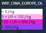
| Available variables | Rainfall, Snow, Graupel, Hail, 2-metre Temperature, 10-metre wind, 2-metre relative humidity, LPI, Elicity | |
| Available accumulations | 3, 6, 12, 24, and 48 hours | |
| Available interpolation algorithms | ||
| Available filters | ||
| Spatial aggregations | NUTS2 |

