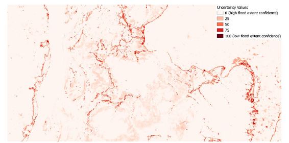
Uncertainty Values
[Home] - [back to GFM Products]
Aggregated uncertainty values are generated along with the binary map product as a simplified appraisal of trust in the ensemble flood extent detection approach.
First, uncertainty information from each of the individual algorithms is expressed in the same numerical range [0, 100] to ensure comparability and to facilitate further harmonization.
In particular, probabilistic values from the LIST algorithm and fuzzy membership values from the DLR algorithm are first converted into classification uncertainty and next multiplied by a factor of 100.
For DLR algorithm , since fuzzy membership values are only assigned to water pixels, all unflooded pixels are assigned a value of 0.
The conversion of these probabilistic (resp. fuzzy membership) values is carried out as:
U = Wi * (100 - Pi) + (1 - Wi) * Pi
where:
- Wi represents the binary water map classification (0 for dry and 1 for water classes)
- U is the uncertainty value
- Pi is the probabilistic (resp. fuzzy membership) value.
TU Wien algorithm classification uncertainty values, ranging from 0 and 1000, are divided by 10 in order to fall with the range [0,100]. Eventually, the average of the uncertainties from the three algorithms is taken.
This has a value in the range of [0, 100], where values towards 100 indicate high confidence in the ensemble flood extent detection approach. Consequently, uncertainty information provided along with the map product communicates how much confidence is associated with the S-1 classification. End users can then use highly certain flood map products to identify resource requirements over areas of flood exposure to make timely emergency response decisions.

