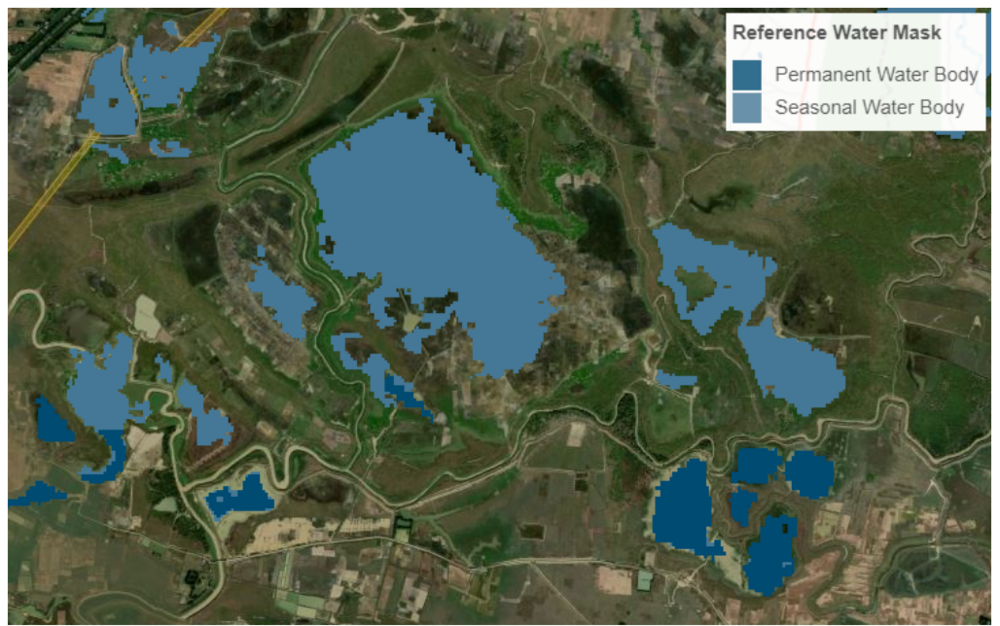
Reference Water Mask (eng)
| Layer name | Reference Water Mask (GFM) |
| Tag | Flood |
| Folder | Eo Satellite |
| Source | Reference Water Mask |
| Description | The Sentinel-1 Reference Water Mask identifies the pixels classified as open and calm water, both permanent and seasonal, using Sentinel-1 SAR backscatter intensity using an ensemble flood mapping algorithm. Whereas the permanent water extent mapping uses as input the median backscatter of all Sentinel-1 data from a time period of two years, the seasonal reference water mapping uses as input the median backscatter of all Sentinel-1 data from a given month over a two-year period. As a result, twelve masks are available, one per month, which includes information on the permanent and seasonal reference water extent. This parameter database is updated once a year. In order to consider uncertainties in the single water segmentations and the occurrence of hydrological extreme events the WO threshold is usually relaxed to a value of 85-90 % (e.g. Pekel et al., 2016[2]). The application of a permanent water mask is reliable in environments with stable hydrological conditions over the year. In geographic regions with strong hydrological dynamics related to temporal change and variation in space of the water extent (e.g. in areas affected by monsoonal effects) the use of a permanent water mask is not reliable and has to be replaced by a seasonal reference water mask, which considers the usual water extent of the respective time period. Within this activity permanent as well as seasonal reference water masks will be computed based on historical Sentinel-1 time-series data in order to distinguish flooded areas from permanent water-bodies and seasonal water fluctuations. The permanent water mask will be based on applying the proposed ensemble water mapping approach on the median backscatter of all Sentinel-1 data covering a time period of two years. If, for example, the currently analysed Sentinel-1 scene is acquired in the year 2021 it will be compared by the permanent reference water mask computed from data of the two previous years 2019 and 2020. The application of the ensemble approach on the median backscatter instead of computing the Water Occurrence based on each single observation has the advantage that the processing efficiency can be strongly increased. The reference water masks will be updated once a year in an offline environment in order to compare the Sentinel-1 observed water extent with the reference water extent of the two previous years. This helps to provide up-to-date reference water masks. The reference period of two years is chosen as compromise in order to base the computation on a sufficient number of Sentinel-1 data and to remove long-term hydrologic changes which would be integrated in the reference waters masks if longer time periods would be considered. References |
| Screenshot | |
| Properties | |
| Available variables | Reference Water Mask |
| Available accumulations | |
| Available interpolation algorithms | |
| Available filters | |
| Spatial aggregations |
