Difference between revisions of "PR OBS 5 H05(eng)"
(Created page with " [Home] - [Observations] <br/> {| class="wikitable" |- |style="background-color: orange;" |Layer name |style="background-color:...") |
|||
| (3 intermediate revisions by the same user not shown) | |||
| Line 1: | Line 1: | ||
| − | [[ | + | [[User Guide | [Home]]] - [[Observations| [Observations]]] <br/> |
| Line 14: | Line 14: | ||
|- | |- | ||
|Source | |Source | ||
| − | | | + | |[http://hsaf.meteoam.it/ EUMETSAT-HSAF] |
|- | |- | ||
|Description | |Description | ||
| Line 25: | Line 25: | ||
Dissemination: By dedicated lines to centres connected by GTS - By EUMETCast to most other users, especially scientific<br> | Dissemination: By dedicated lines to centres connected by GTS - By EUMETCast to most other users, especially scientific<br> | ||
Formats: GRIB - Also JPEG or similar for quick-look | Formats: GRIB - Also JPEG or similar for quick-look | ||
| + | |||
| + | More info at: [http://hsaf.meteoam.it/description-pr-obs-5.php PR OBS5 H05 documentation on line] | ||
|- | |- | ||
|Screenshot | |Screenshot | ||
| − | |[[File: | + | |[[File:PR_obs_5.PNG|1000px|thumb|centre|]] |
|[[File:all_leg_rfm.JPG|800px|thumb|centre|Legend]] | |[[File:all_leg_rfm.JPG|800px|thumb|centre|Legend]] | ||
|- | |- | ||
| Line 34: | Line 36: | ||
|- | |- | ||
|Available variables | |Available variables | ||
| − | | | + | |Rain depth |
|- | |- | ||
|Available accumulations | |Available accumulations | ||
| Line 51: | Line 53: | ||
---- | ---- | ||
| − | [[ | + | [[User Guide | [Home]]] - [[Observations| [Observations]]] <br/> |
Latest revision as of 13:37, 18 August 2021
| Layer name | PR OBS 5 - H05 | |
| Tag | Rain | |
| Folder | ||
| Source | EUMETSAT-HSAF | |
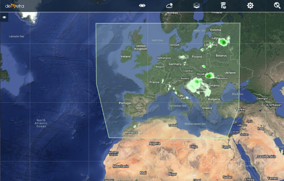
| Description | Derived from precipitation maps generated by merging MW images from operational sun-synchronous satellites and IR images from geostationary satellites (i.e., products PR-OBS-3 and PR-OBS-4). Presented in polar stereographic projection. Coverage: The rectangular area of the stereographic projection that includes the H-SAF area [25-75°N lat, 25°W-45°E long] More info at: PR OBS5 H05 documentation on line | |
| Screenshot | ||
| Properties | ||
| Available variables | Rain depth | |
| Available accumulations | 1, 3, 6, 12 and 24 hours | |
| Available interpolation algorithms | ||
| Available filters | ||
| Spatial aggregations |

