Difference between revisions of "Observed Water Extent (eng)"
From MyDewetra World
(Created page with " [Home] - [Observations] <br/> {| class="wikitable" |- |style="background-color: orange;" |Layer name |style="background-color: orange;"| O...") |
|||
| Line 19: | Line 19: | ||
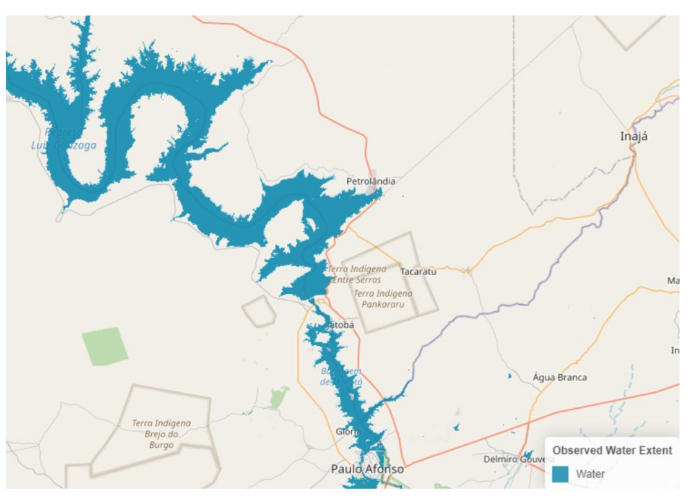
| The '''Sentinel-1 Observed Water Extent''' identifies the pixels classified as open and calm water using Sentinel-1 SAR backscatter intensity and is derived using the ensemble flood mapping algorithm. <br> | | The '''Sentinel-1 Observed Water Extent''' identifies the pixels classified as open and calm water using Sentinel-1 SAR backscatter intensity and is derived using the ensemble flood mapping algorithm. <br> | ||
To map water extent pixels for a certain date, the algorithm uses as input the Sentinel-1 data overpass plus offline-generated Sentinel-1 SAR parameters and auxiliary thematic datasets such as Exclusion Mask and topography(e.g. DEM and HAND index). <br> | To map water extent pixels for a certain date, the algorithm uses as input the Sentinel-1 data overpass plus offline-generated Sentinel-1 SAR parameters and auxiliary thematic datasets such as Exclusion Mask and topography(e.g. DEM and HAND index). <br> | ||
| − | The relative orbit path information, to select the corresponding offline-generated Sentinel-1 SAR parameters, is extracted from the“Sentinel-1 Metadata”. All the processing is done at the 20m-sampling of the Sentinel-1 pre-processed data cube. The Sentinel-1 Observed Water Extent values are described below. |- | + | The relative orbit path information, to select the corresponding offline-generated Sentinel-1 SAR parameters, is extracted from the“Sentinel-1 Metadata”. All the processing is done at the 20m-sampling of the Sentinel-1 pre-processed data cube. The Sentinel-1 Observed Water Extent values are described below. |
| + | |- | ||
|Screenshot | |Screenshot | ||
|[[File:GFMOBWE.png|1000px|thumb|centre|]] | |[[File:GFMOBWE.png|1000px|thumb|centre|]] | ||
Revision as of 09:53, 4 August 2022
| Layer name | Observed Water Extent (GFM) |
| Tag | Flood |
| Folder | Eo Satellite |
| Source | Observed Water Extent |
| Description | The Sentinel-1 Observed Water Extent identifies the pixels classified as open and calm water using Sentinel-1 SAR backscatter intensity and is derived using the ensemble flood mapping algorithm. To map water extent pixels for a certain date, the algorithm uses as input the Sentinel-1 data overpass plus offline-generated Sentinel-1 SAR parameters and auxiliary thematic datasets such as Exclusion Mask and topography(e.g. DEM and HAND index). |
| Screenshot | |
| Properties | |
| Available variables | Observed Water Extent |
| Available accumulations | |
| Available interpolation algorithms | |
| Available filters | |
| Spatial aggregations |
