Difference between revisions of "COSMO-MED(eng)"
From MyDewetra World
| Line 17: | Line 17: | ||
|- | |- | ||
|Description | |Description | ||
| − | |The model provides deterministic products with a limited area, useful for medium-short term forecasting (up to the expiry of +72 hours) and its definition on smaller spatial scales, is managed by [http: //www.arpae. it / sim / ARPA-SIMC Emilia Romagna] jointly with [http://www.meteoam.it/page/centro-nazionale-di-meteorologia-e-climatologia-aeronautica-cnmca CNMCA] (National Center for Aeronautical Meteorology and Climatology ) of the Air Force as part of the international collaboration project [http://www.cosmo-model.org/ COSMO]. This model runs | + | |The model provides deterministic products with a limited area, useful for medium-short term forecasting (up to the expiry of +72 hours) and its definition on smaller spatial scales, is managed by [http: //www.arpae. it / sim / ARPA-SIMC Emilia Romagna] jointly with [http://www.meteoam.it/page/centro-nazionale-di-meteorologia-e-climatologia-aeronautica-cnmca CNMCA] (National Center for Aeronautical Meteorology and Climatology ) of the Air Force as part of the international collaboration project [http://www.cosmo-model.org/ COSMO]. This model runs twice a day, at 00:00 and at 12.00, providing a forecast of the two-dimensional weather fields with a horizontal resolution of about 5km, covering the whole Mediterranean territory. It is possible to select cumulative over a greater number of hours and view the results on different spatial aggregations on a regional scale, the borders of the provinces, municipal borders, Countries, weather surveillance areas, alert areas and basins. |
|- | |- | ||
Latest revision as of 14:40, 4 August 2022
| Layer name | COSMO MED | |
| Tag | Meteorological Models | |
| Folder | Meteorological Models | |
| Source | COSMO MED | |
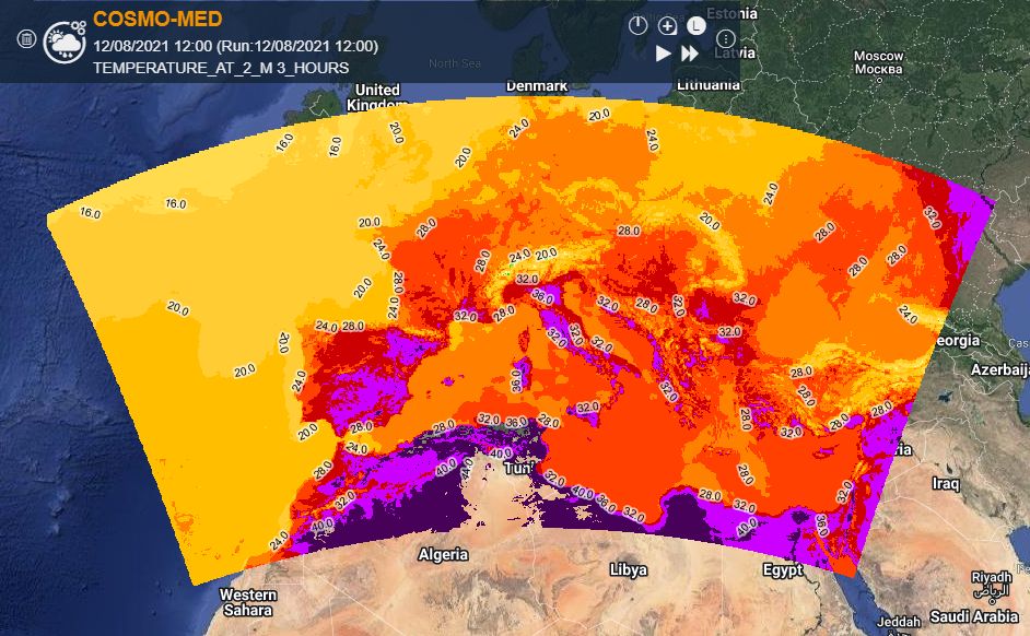
| Description | The model provides deterministic products with a limited area, useful for medium-short term forecasting (up to the expiry of +72 hours) and its definition on smaller spatial scales, is managed by [http: //www.arpae. it / sim / ARPA-SIMC Emilia Romagna] jointly with CNMCA (National Center for Aeronautical Meteorology and Climatology ) of the Air Force as part of the international collaboration project COSMO. This model runs twice a day, at 00:00 and at 12.00, providing a forecast of the two-dimensional weather fields with a horizontal resolution of about 5km, covering the whole Mediterranean territory. It is possible to select cumulative over a greater number of hours and view the results on different spatial aggregations on a regional scale, the borders of the provinces, municipal borders, Countries, weather surveillance areas, alert areas and basins. | |
| Screenshot | ||
| Properties | ||
| Available variables | 1 hr precipitation [mm] Snow [mm] Temperature at 2m [° C] | |
| Available accumulations | 3, 6, 12, 24, 48, 72 hours (for total precipitation) | |
| Available interpolation algorithms | ||
| Available filters | ||
| Spatial aggregations | Municipalities, Provinces, Regions, World regions, Meteoclimatic Surveillance Areas, Warning Areas, Main River Basins |

