GRACE(eng)
| Layer name | Total Water Storage Anomaly Map (GDO) |
| Tag | Flood |
| Folder | Eo Satellite |
| Source | GRACE |
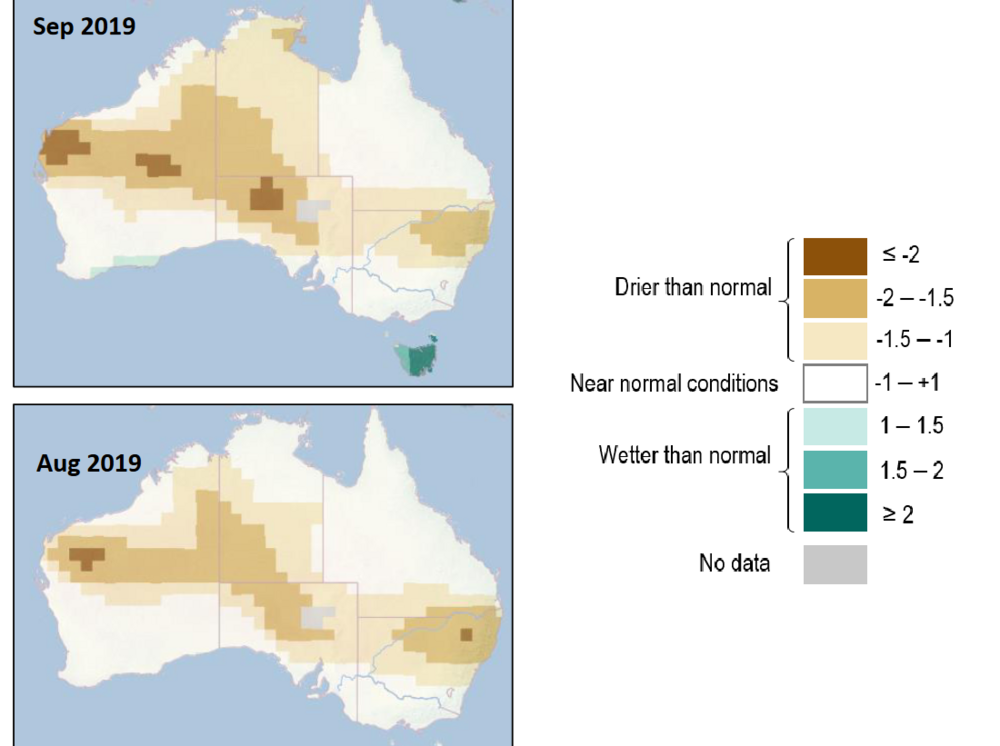
| Description | The Total Water Storage (TWS) Anomaly indicator that is implemented in the Copernicus Global
Drought Observatory (GDO) is used for determining the occurrence of long-term hydrological drought conditions, which arise when the TWS reaches values lower than usual. This quantity is often used as a proxy of groundwater drought. The TWS Anomaly indicator in GDO is computed as anomalies of GRACE-derived TWS data - which are produced by the Center for Space Research (CSR) at the University of Texas at Austin, as scaled by the NASA Jet Propulsion Laboratory (JPL) (available at: JPL Nasa). Details on the comparison between this dataset and multiple timescale SPI can be find in Cammalleri et al. (2019) The Total Water Storage (TWS) is the sum of all above and below surface water storages, including canopy water, rivers and lakes, soil moisture and groundwater, and it represents a synthetic proxy of the dynamic of slow-responding hydrological quantities. The TWS remote estimates from the GRACE-FO pair of satellites are used to compute the anomaly from the climatological reference period (2002-2018), and it is updated monthly, with a latency of about 45 days. The TWS Anomaly indicator is used to detect and monitor long-term hydrological drought, which complements more fast-responding indicators, such as soil moisture and streamflow droughts. For further information see the GRACE Factsheet |
| Screenshot | |
| Properties | |
| Available variables | Water Storage Anomaly |
| Available accumulations | |
| Available interpolation algorithms | |
| Available filters | |
| Spatial aggregations |
