Difference between revisions of "Sentinel-1 Metadata"
(Created page with " [Home] - [back to GFMS Products] ---- The '''Sentinel-1 metadata''' layer consist of all available metadata attributes provided with each Sentinel-1...") |
(No difference)
|
Revision as of 10:23, 12 November 2020
[Home] - [back to GFMS Products]
The Sentinel-1 metadata layer consist of all available metadata attributes provided with each Sentinel-1 GRD data product used in the generation of the global flood monitoring product.
Metadata of each Sentinel-1 GRD scene is encompassed in the distributed Sentinel “Standard Archive Format for Europe (SAFE)” format included in the “manifest.safe” file. The manifest file is an XML file containing the mandatory product metadata.
Attributes contained in the manifest file are classified into four categories:
- summary
- product
- platform
- instrument
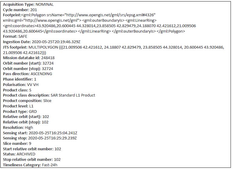
Platform and instrument related attributes are considered as static for the different Sentinel-1 satellites. A total number of 29 attributes are contained in the manifest file such as information about the absolute orbit number, pass direction, polarisation, sensing start and end date and the product timeliness category. An abstract of the included attributes is given in hereafter as an example.
After successful retrieval of a Sentinel-1 GRD product at EODC the manifest file is parsed and inserted into the operated metadata database.
Access to the actively maintained metadata base is given via the well-defined OGC CSW standard referred to as metadata catalogue.
The database itself builds upon PostgreSQL following a relational database system.
The request Sentinel-1 metadata layer is provided via PostGIS representing a spatial database extender of the PostgreSQL database. The PostGIS layer allows on-demand querying of geographic objects conform to OGC mapping standards such as WMS-T, WCS or WFS.
