Difference between revisions of "Tools"
From MyDewetra World
(→Add a WMS) |
|||
| Line 15: | Line 15: | ||
Once the user has selected the function, the following for is displayed: | Once the user has selected the function, the following for is displayed: | ||
| − | [[ | + | [[File:TO_02eng.JPG|800px|thumb|centre|]] |
---- | ---- | ||
[[User Guide | [Home]]] - [[GUI (user interface) | [User Interface]]] - [[Observations | [Observations]]] - [[Forecast Models | [Forecast Models]]] - [[Static Layers | [Static Layers]]] - [[Events | [Events]]] | [[User Guide | [Home]]] - [[GUI (user interface) | [User Interface]]] - [[Observations | [Observations]]] - [[Forecast Models | [Forecast Models]]] - [[Static Layers | [Static Layers]]] - [[Events | [Events]]] | ||
Revision as of 20:45, 18 November 2018
[Home] - [User Interface] - [Observations] - [Forecast Models] - [Static Layers] - [Events]
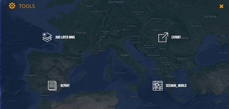
The fifth action button of the Toolbar is the Tools menu, which provides the users with some useful functions that are available within the platform. Once the user clicks on the menu, the available tools shown as listed below:
Add a WMS
This function allows the users to add to the list of the available layers any data (raster, vector, geotiff) that can be provided through a WMS.
Once the user has selected the function, the following for is displayed:
[Home] - [User Interface] - [Observations] - [Forecast Models] - [Static Layers] - [Events]

