Difference between revisions of "GLOFAS(eng)"
(Created page with " [Home] - [Forecast Models] {| class="wikitable" |- |style="background-color: orange;" |Layer name |style="background-color: orange;"|G...") |
(No difference)
|
Revision as of 22:29, 16 November 2018
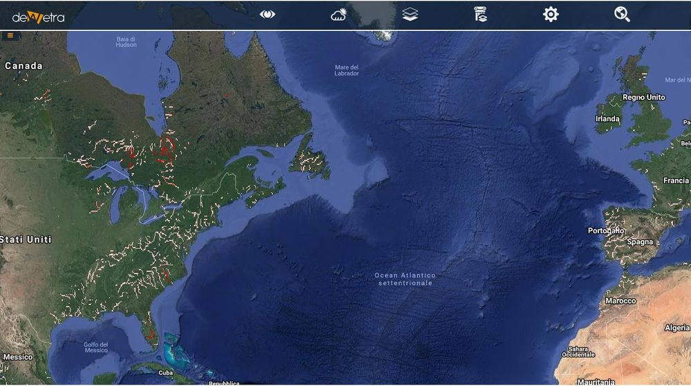
| Layer name | GLOFAS Alert Probability | |
| Tag | Hydrological Models | |
| Folder | ||
| Source | Global Flood Awareness System | |
| Description | GloFAS 30-day v2.0 technical settings
GloFAS 30-day v2.0 uses the Lisflood river routing model (van der Knijff et al., 2010) to propagate along the river channel the surface and sub-surface runoff forecasts of the HTESSEL land surface model (Balsamo et al., 2009) of the ECMWF ENS medium- and extended-range forecasting system to produce daily discharge forecasts. In GloFAS 30-day v2.0, Lisflood was calibrated for better accounting for the variability in the hydrological processes (Hirpa et. al., 2018). More details can be found in the Lisflood calibration page. ECMWF-ENS is the ensemble forecast of ECMWF and consists of 51 members at ~ 18 km resolution up to 15 days, increasing to ~36 km from day 16 to 30. ECMWF ENS runoff forecasts are resampled to 0.1 spatial resolution (~10 km) before being used as daily input to Lisflood to produce discharge up to day 15; from day 16 the latest available extended range forecast is used as forcing to produce seamless discharge forecasts for 30 days. GloFAS 30-day v2.0 initial conditions (atmosphere and land surface states from which to start the ensemble discharge forecast) are based on a 5-day monitoring analysis of the latest proxy-observations, the ERA5 ECMWF reanalysis. Because of ERA5’s has a ~2 days latency (compared with real time), ERA5 is used only as long as it is available; for the remaining 2 to 3 days, prior to the GloFAS 30-day forecast, the day-1 of ECMWF-ENS-CNTL forecast is taken as input. More info at: GLOFAS documentation on line | |
| Screenshot | ||
| Properties | ||
| Available variables | Expected flood (return period = 1, 2, 5, 20, 20+ years) | |
| Available accumulations | ||
| Available interpolation algorithms | ||
| Available filters | ||
| Spatial aggregations |
