Difference between revisions of "LSASAF FRP(eng)"
From MyDewetra World
(Created page with " [Home] - [Observations] <br/> {| class="wikitable" |- |style="background-color: orange;" |Layer name |style="background-color: orange;"|LS...") |
(No difference)
|
Revision as of 14:00, 16 November 2018
| Layer name | LSA-SAF Fire Radiative Power | |
| Tag | Fires | |
| Folder | ||
| Source | EUMETSAT-SAF | |
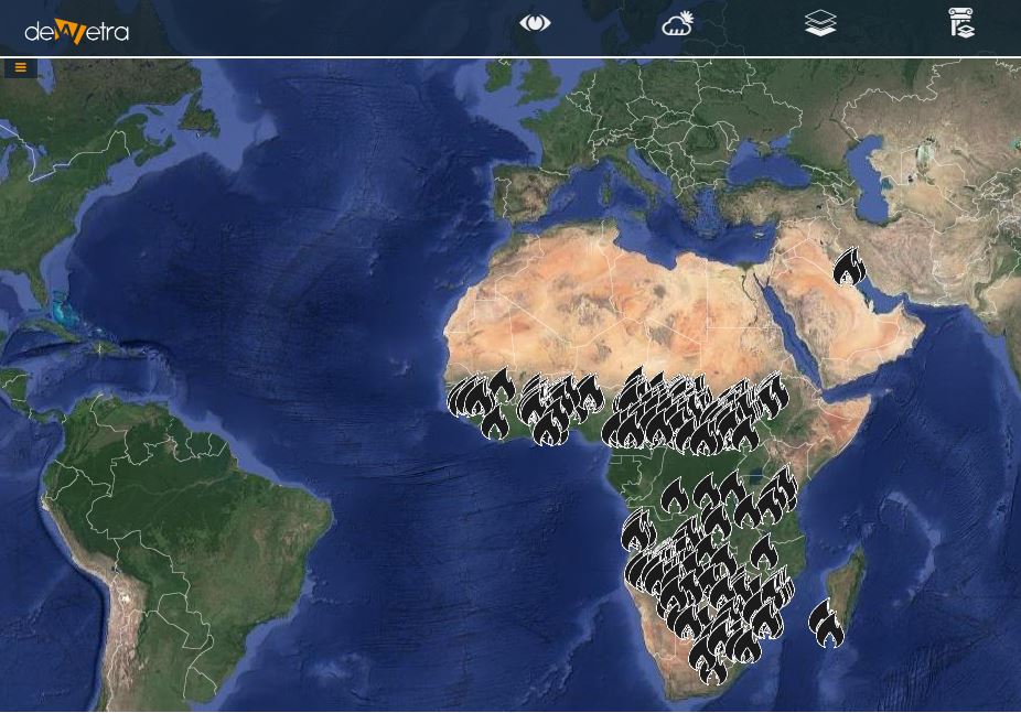
| Description | The FRPPIXEL product records information on the location, timing and fire radiative power (FRP, in MWatts) output of landscape fires ("wildfires") detected every 15 minutes across the full Meteosat disk at the native spatial resolution of the SEVIRI sensor. It has been demonstrated in small-scale experimental fires that the amount of radiant heat liberated in a fire per unit time (i.e. the Fire Radiative Power) is well related to the rate at which fuel is being consumed [3]. This is a direct result of the combustion process, whereby carbon-based fuel is oxidised to CO2 (and other gaseous and particulate products) with the accompanying release of a certain "heat yield". Measuring this FRP and integrating it over the lifetime of a fire provides an estimate of the total Fire Radiative Energy (FRE) released, which for landscape fires should be proportional to the total amount of biomass burned. The FRP approach therefore provides an alternative approach to calculating wildfire fuel consumption through methods that rely on the mapping of burned area and assuming, measuring or modelling the supposed fuel consumption per unit area. It is the basis of the global fire emissions service (GFAS) used within the Copernicus Atmosphere Monitoring Service.
More info at: FRP-LSASAF documentation on line | |
| Screenshot | ||
| Properties | ||
| Available variables | Fire radiative power | |
| Available accumulations | ||
| Available interpolation algorithms | ||
| Available filters | ||
| Spatial aggregations |

