Difference between revisions of "Uncertainty Values (eng)"
(Created page with " [Home] - [Observations] <br/> {| class="wikitable" |- |style="background-color: orange;" |Layer name |style="background-color: orange;"| U...") |
(No difference)
|
Latest revision as of 10:14, 4 August 2022
| Layer name | Uncertainty values (GFM) |
| Tag | Flood |
| Folder | Eo Satellite |
| Source | Uncertainty values |
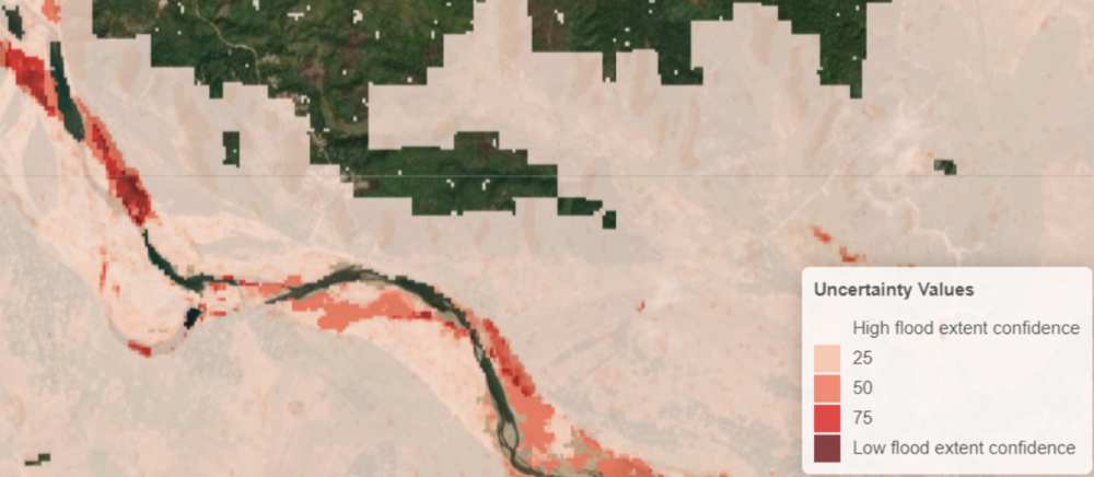
| Description | Aggregated uncertainty values are generated along with the binary map product as a simplified appraisal of trust in the ensemble flood extent detection approach. First, uncertainty information from each of the individual algorithms is expressed in the same numerical range [0, 100] to ensure comparability and to facilitate further harmonization. In particular, probabilistic values from the LIST algorithm and fuzzy membership values from the DLR algorithm are first converted into classification uncertainty and next multiplied by a factor of 100. For DLR algorithm , since fuzzy membership values are only assigned to water pixels, all unflooded pixels are assigned a value of 0.
TU Wien algorithm classification uncertainty values, ranging from 0 and 1000, are divided by 10 in order to fall with the range [0,100]. Eventually, the average of the uncertainties from the three algorithms is taken. |
| Screenshot | |
| Properties | |
| Available variables | Uncertainty values |
| Available accumulations | |
| Available interpolation algorithms | |
| Available filters | |
| Spatial aggregations |
