Difference between revisions of "Exclusion Mask (eng)"
From MyDewetra World
(Created page with " [Home] - [Observations] <br/> {| class="wikitable" |- |style="background-color: orange;" |Layer name |style="background-color: orange;"|Ex...") |
|||
| Line 14: | Line 14: | ||
|- | |- | ||
|Source | |Source | ||
| − | |[https://extwiki.eodc.eu/GFM/PUM/Products/ | + | |[https://extwiki.eodc.eu/GFM/PUM/Products/Exclusion-Mask Exclusion-Mask] |
|- | |- | ||
|Description | |Description | ||
Latest revision as of 09:33, 4 August 2022
| Layer name | Exclusion Mask (GFM) |
| Tag | Flood |
| Folder | Eo Satellite |
| Source | Exclusion-Mask |
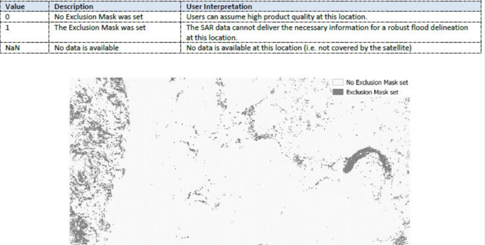
| Description | The Exclusion Mask indicates the pixel locations where the SAR data could not deliver the necessary information for a robust flood delineation. It combines static effects leading to
For its generation, we implement the methods proposed in section 1, following the identified problems of SAR-based flood mapping. |
| Screenshot | |
| Properties | |
| Available variables | Exclusion Mask |
| Available accumulations | |
| Available interpolation algorithms | |
| Available filters | |
| Spatial aggregations |
