Difference between revisions of "LHASA(eng)"
From MyDewetra World
(Created page with " [Home] - [Forecast Models] {| class="wikitable" |- |style="background-color: orange;" |Layer name |style="background-color: orange;"|L...") |
|||
| Line 14: | Line 14: | ||
|- | |- | ||
|Source | |Source | ||
| − | |[https:// | + | |[https://www.nasa.gov/ NASA] |
|- | |- | ||
|Description | |Description | ||
Revision as of 16:21, 24 November 2020
| Layer name | LHASA | ||
| Tag | Landslides | ||
| Folder | |||
| Source | NASA | ||
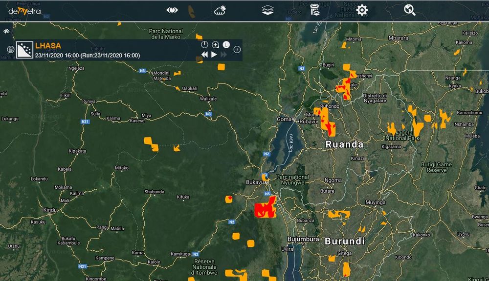
| Description | The global Landslide Hazard Assessment for Situational Awareness (LHASA) model was developed to provide situational awareness of landslide hazards for a wide range of users. The model combines TRMM and GPM near real-time precipitation data with a global landslide susceptibility map to generate estimates of where and when rainfall-triggered landslides are likely to occur around the world. Information on landslide reports is available on the Cooperative Open Online Landslide Repository (COOLR), which combines data from NASA's Global Landslide Catalog, other landslide inventories and contributions from citizen scientists via the Landslide Reporter Application.
More info at: documentation on line | ||
| Screenshot | |||
| Properties | |||
| Available variables | PM2.5 denisty in micrograms per cubic metre | ||
| Available accumulations | |||
| Available interpolation algorithms | |||
| Available filters | |||
| Spatial aggregations |
