Difference between revisions of "Copernicus SWI(eng)"
From MyDewetra World
(Created page with " [Home] - [Observations] <br/> {| class="wikitable" |- |style="background-color: orange;" |Layer name |style="background-color: orange;"|So...") |
|||
| Line 30: | Line 30: | ||
|- | |- | ||
|Available variables | |Available variables | ||
| − | |Soil water index | + | |Soil water index at 1, 5, 10, 15, 20, 40, 60 and 100cm |
|- | |- | ||
|Available accumulations | |Available accumulations | ||
Latest revision as of 13:41, 16 November 2018
| Layer name | Soil Water index (SWI) | |
| Tag | Soil Moisture | |
| Folder | ||
| Source | Copernicus Global Land Service | |
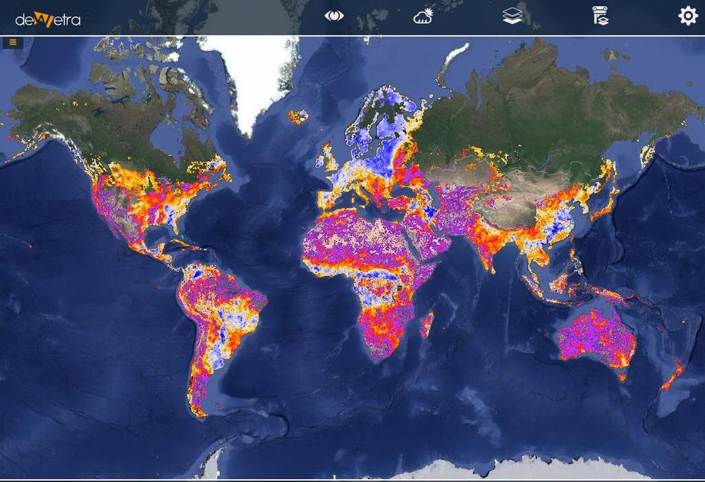
| Description | The Soil Water Index quantifies the moisture condition at various depths in the soil. It is mainly driven by the precipitation via the process of infiltration. Soil moisture is a very heterogeneous variable and varies on small scales with soil properties and drainage patterns. Satellite measurements integrate over relative large-scale areas, with the presence of vegetation adding complexity to the interpretation.
The soil moisture, up to 5cm soil depth, is recognized as an Essential Climate Variable (ECV) by the Global Climate Observing System (GCOS). More info at: Copernicus SWI documentation on line | |
| Screenshot | ||
| Properties | ||
| Available variables | Soil water index at 1, 5, 10, 15, 20, 40, 60 and 100cm | |
| Available accumulations | ||
| Available interpolation algorithms | ||
| Available filters | ||
| Spatial aggregations |
