Difference between revisions of "ECMWF-ENS(eng)"
(Created page with " [Home] - [Forecast Models] {| class="wikitable" |- |style="background-color: orange;" |Layer name |style="background-color: orange;"|E...") |
|||
| (2 intermediate revisions by the same user not shown) | |||
| Line 17: | Line 17: | ||
|- | |- | ||
|Description | |Description | ||
| − | | | + | |For the medium-range forecasts an ensemble of 52 individual ensemble members are created twice a day. One member is at a higher spatial resolution than the other members (called the HRES at ECMWF), its initial state is the most accurate estimate of the current conditions and it uses the currently best description of the model physics. |
| − | The | + | |
| − | + | The HRES provides a highly detailed description of future weather and averaged over many forecasts it is the most accurate forecast for a certain period, which is currently estimated as 10 days for large scale properties of the atmosphere. However for any particular forecast it may not be the most skilful member of the ensemble. Also when viewed in isolation it cannot provide an estimate of forecast uncertainty or confidence. | |
| + | |||
| + | Another member of the ensemble (CNTL: Control forecast) is at a lower spatial resolution than the HRES but at that lower resolution it utilises the most accurate estimate of the current conditions and the currently best description of the model physics. Its significance for the ensemble is that it provides the unperturbed member to which the perturbations for the remainder of the ensemble members are applied. | ||
| + | |||
| + | The perturbed members (50 members) are similar to the CNTL but their initial states and model physics have been perturbed to explore the currently understood range of uncertainty in the observations and the model. They provide a range of possible future weather states. When averaged over many forecasts (although not necessarily for any particular forecast) these have lower skill than either the HRES or the CNTL. However they do provide an estimate of the forecast uncertainty or confidence. | ||
| + | |||
| + | The CNTL and perturbed members are continued beyond fifteen days at a reduced horizontal resolution. | ||
| + | |||
| + | The sections below highlight the variety of ECMWF medium-range forecast products. | ||
| + | |||
| + | Depending on who you are, you will be able to access different types of products. The linked charts are only displayed if you have correct access rights for that product. | ||
More info at: [https://www.ecmwf.int/en/elibrary/19749-part-v-ensemble-prediction-system ECMWF-ENS documentation on line] | More info at: [https://www.ecmwf.int/en/elibrary/19749-part-v-ensemble-prediction-system ECMWF-ENS documentation on line] | ||
| Line 28: | Line 38: | ||
|[[File:all_leg_ecmwfens.JPG|800px|thumb|centre|Legend]] | |[[File:all_leg_ecmwfens.JPG|800px|thumb|centre|Legend]] | ||
|- | |- | ||
| + | |Screenshot | ||
|[[File:all_ecmwfens2.JPG|1000px|thumb|centre|]] | |[[File:all_ecmwfens2.JPG|1000px|thumb|centre|]] | ||
| − | |[[File: | + | |[[File:all_leg_ecmwfens21.JPG|800px|thumb|centre|Legend]] |
|- | |- | ||
|style="background-color: grey;"| Properties | |style="background-color: grey;"| Properties | ||
| Line 38: | Line 49: | ||
|- | |- | ||
|Available accumulations | |Available accumulations | ||
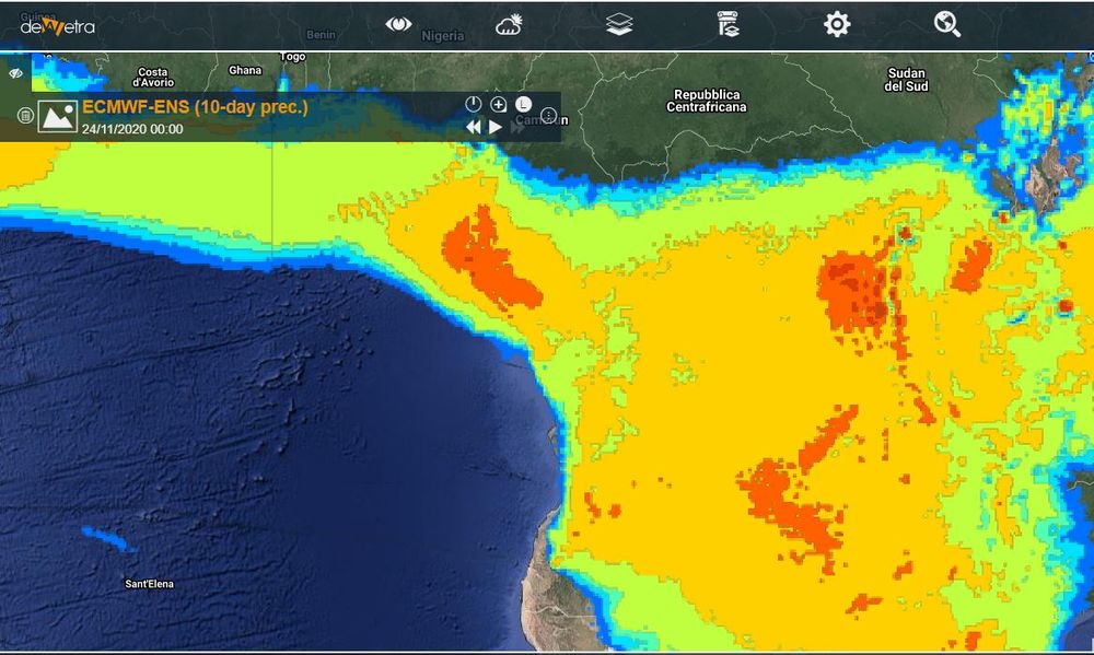
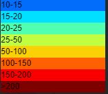
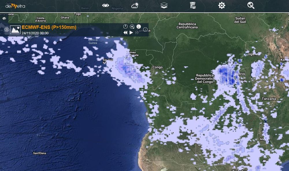
| − | | | + | |Amount of accumulated rainfall over the forecast range of 10 days for the median of the ensemble ECMWF forecast; Probability [%] of exceeding 50-150-300 mm of accumulated rainfall over the forecast range of 10 days for the ensemble ECMWF forecast. |
|- | |- | ||
|Available interpolation algorithms | |Available interpolation algorithms | ||
Latest revision as of 15:56, 24 November 2020
| Layer name | ECMWF-ENS | |
| Tag | Meteorological Models | |
| Folder | ||
| Source | ECMWF | |
| Description | For the medium-range forecasts an ensemble of 52 individual ensemble members are created twice a day. One member is at a higher spatial resolution than the other members (called the HRES at ECMWF), its initial state is the most accurate estimate of the current conditions and it uses the currently best description of the model physics.
The HRES provides a highly detailed description of future weather and averaged over many forecasts it is the most accurate forecast for a certain period, which is currently estimated as 10 days for large scale properties of the atmosphere. However for any particular forecast it may not be the most skilful member of the ensemble. Also when viewed in isolation it cannot provide an estimate of forecast uncertainty or confidence. Another member of the ensemble (CNTL: Control forecast) is at a lower spatial resolution than the HRES but at that lower resolution it utilises the most accurate estimate of the current conditions and the currently best description of the model physics. Its significance for the ensemble is that it provides the unperturbed member to which the perturbations for the remainder of the ensemble members are applied. The perturbed members (50 members) are similar to the CNTL but their initial states and model physics have been perturbed to explore the currently understood range of uncertainty in the observations and the model. They provide a range of possible future weather states. When averaged over many forecasts (although not necessarily for any particular forecast) these have lower skill than either the HRES or the CNTL. However they do provide an estimate of the forecast uncertainty or confidence. The CNTL and perturbed members are continued beyond fifteen days at a reduced horizontal resolution. The sections below highlight the variety of ECMWF medium-range forecast products. Depending on who you are, you will be able to access different types of products. The linked charts are only displayed if you have correct access rights for that product. More info at: ECMWF-ENS documentation on line | |
| Screenshot | ||
| Screenshot | ||
| Properties | ||
| Available variables | Rainfall, 2-metre Temperature, 10-metre wind, 2-metre relative humidity | |
| Available accumulations | Amount of accumulated rainfall over the forecast range of 10 days for the median of the ensemble ECMWF forecast; Probability [%] of exceeding 50-150-300 mm of accumulated rainfall over the forecast range of 10 days for the ensemble ECMWF forecast. | |
| Available interpolation algorithms | ||
| Available filters | ||
| Spatial aggregations | NUTS2 |


