Difference between revisions of "Global Lakes and Wetlands Database(eng)"
| (One intermediate revision by the same user not shown) | |||
| Line 14: | Line 14: | ||
|- | |- | ||
|Source | |Source | ||
| − | |[ | + | |[http://www.worldwildlife.org/pages/hydrosheds WWF/USGS] |
|- | |- | ||
|Description | |Description | ||
| Line 24: | Line 24: | ||
For GLWD-3, the polygons of GLWD-1 and GLWD-2 were combined with additional information on the maximum extents and types of wetlands. Class ‘lake’ in both GLWD-2 and GLWD-3 also includes man-made reservoirs, as only the largest reservoirs have been distinguished from natural lakes.<br> | For GLWD-3, the polygons of GLWD-1 and GLWD-2 were combined with additional information on the maximum extents and types of wetlands. Class ‘lake’ in both GLWD-2 and GLWD-3 also includes man-made reservoirs, as only the largest reservoirs have been distinguished from natural lakes.<br> | ||
| − | More info at: [https://www.worldwildlife.org/pages/global-lakes-and-wetlands-database | + | More info at: [https://www.worldwildlife.org/pages/global-lakes-and-wetlands-database HydroSHEDS] |
|- | |- | ||
|Screenshot | |Screenshot | ||
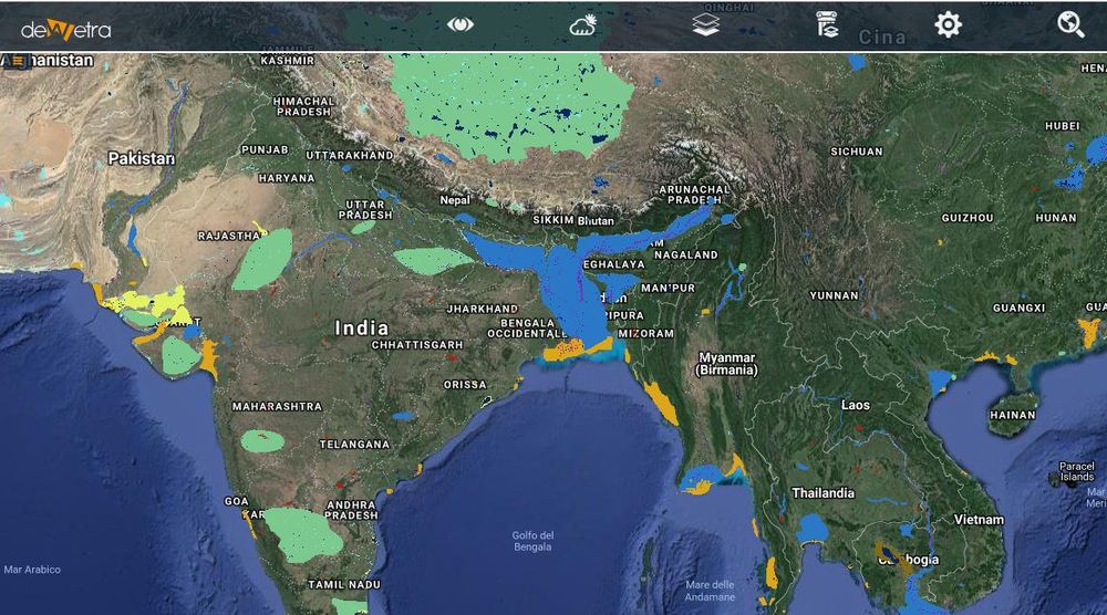
|[[File:all_globlakes.JPG|1000px|thumb|centre|]] | |[[File:all_globlakes.JPG|1000px|thumb|centre|]] | ||
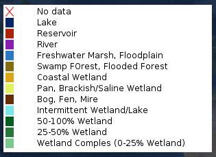
| − | |[[File: | + | |[[File:all_globlakes_leg2.JPG|600px|thumb|centre|]] |
|} | |} | ||
Latest revision as of 09:36, 24 April 2020
| Layer name | Global Lakes and Wetlands Database | |
| Tag | Basic | |
| Folder | ||
| Source | WWF/USGS | |
| Description | Drawing upon a variety of existing maps, data and information, WWF and the Center for Environmental Systems Research, University of Kassel, Germany created the Global Lakes and Wetlands Database (GLWD). The combination of best available sources for lakes and wetlands on a global scale (1:1 to 1:3 million resolution), and the application of GIS functionality enabled the generation of a database which focuses in three coordinated levels on (1) large lakes and reservoirs, (2) smaller water bodies, and (3) wetlands.
Level 1 (GLWD-1) comprises the 3067 largest lakes (area ≥ 50 km2) and 654 largest reservoirs (storage capacity ≥ 0.5 km3) worldwide, and includes extensive attribute data. Level 2 (GLWD-2) comprises permanent open water bodies with a surface area ≥ 0.1 km2 excluding the water bodies contained in GLWD-1. The approximately 250,000 polygons of GLWD-2 are attributed as lakes, reservoirs and rivers. Level 3 (GLWD-3) comprises lakes, reservoirs, rivers and different wetland types in the form of a global raster map at 30-second resolution. For GLWD-3, the polygons of GLWD-1 and GLWD-2 were combined with additional information on the maximum extents and types of wetlands. Class ‘lake’ in both GLWD-2 and GLWD-3 also includes man-made reservoirs, as only the largest reservoirs have been distinguished from natural lakes. More info at: HydroSHEDS | |
| Screenshot |

