Difference between revisions of "MODIS Hotspots(eng)"
From MyDewetra World
(Created page with " [Home] - [Observations] <br/> {| class="wikitable" |- |style="background-color: orange;" |Layer name |style="background-color: orange;"|MO...") |
|||
| (2 intermediate revisions by the same user not shown) | |||
| Line 14: | Line 14: | ||
|- | |- | ||
|Source | |Source | ||
| − | |[https:// | + | |[https://firms.modaps.eosdis.nasa.gov/ FIRMS-NASA] |
|- | |- | ||
|Description | |Description | ||
| Line 24: | Line 24: | ||
|Screenshot | |Screenshot | ||
|[[File:all_modis.JPG|1000px|thumb|centre|]] | |[[File:all_modis.JPG|1000px|thumb|centre|]] | ||
| − | |||
|- | |- | ||
|style="background-color: grey;"| Properties | |style="background-color: grey;"| Properties | ||
| Line 33: | Line 32: | ||
|- | |- | ||
|Available accumulations | |Available accumulations | ||
| − | | | + | |24 hours, 48 hours, 1 week |
|- | |- | ||
|Available interpolation algorithms | |Available interpolation algorithms | ||
Latest revision as of 20:25, 18 February 2020
| Layer name | MODIS HotSpots |
| Tag | Fires |
| Folder | |
| Source | FIRMS-NASA |
| Description | The MODIS active fire product detects fires in 1-km pixels that are burning at the time of overpass under relatively cloud-free conditions using a contextual algorithm. Please see the MODIS Active Fire Product User's Guide for detailed information about the MODIS active fire product suite.
More info at: MODIS HotSpots documentation on line |
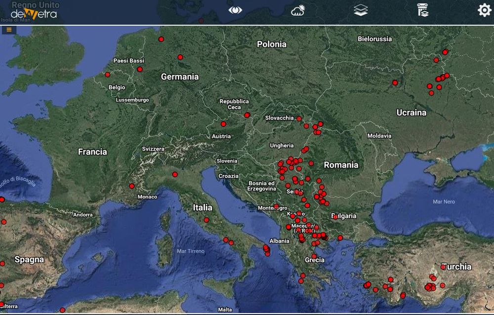
| Screenshot | |
| Properties | |
| Available variables | Hot spots |
| Available accumulations | 24 hours, 48 hours, 1 week |
| Available interpolation algorithms | |
| Available filters | |
| Spatial aggregations |
